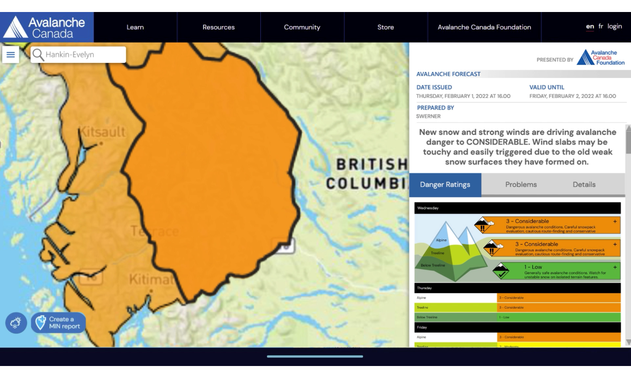


Avalanche Canada has just introduced a new flexible forecast system that makes it easier for riders to get the information they need to plan safe trips into the backcountry.
With the new system, forecast regions are dynamic, with boundaries that change in response to conditions. This allows forecasters to communicate variability more effectively. For example, regions impacted by weather systems or existing avalanche problems can be separated from areas that are not affected. When conditions are relatively uniform over large areas, riders can expect to see fewer forecast regions. Conversely, when variability is high, there will be more forecast regions to reflect this. Forecasters will determine the regional boundaries every day, so there are no longer fixed forecast regions or region names. The information in the forecasts is now more tailored to expected conditions.
The Avalanche Canada homepage map also has a new look and feel. Riders can quickly determine their forecast region by using the new search functionality. To do this, riders simply enter their destination in the search bar. The map will centre on that location, and the rider can open the corresponding forecast with a single click.
The regions are now coloured to reflect their highest danger rating. This, along with the ability to hover over a region and see an abbreviated description of that rating, enables riders to better visualize the danger where they plan to recreate. Map layers and other pertinent information can be added or removed from the forecast map, and Avalanche Canada has implemented a colour-blind safe version to improve accessibility. These design changes reflect best practices in risk communication and are consistent with the approach used by most public forecasting agencies worldwide.
To learn more, visit the Avalanche Canada FAQ page or watch the Flexible Forecast Regions video.